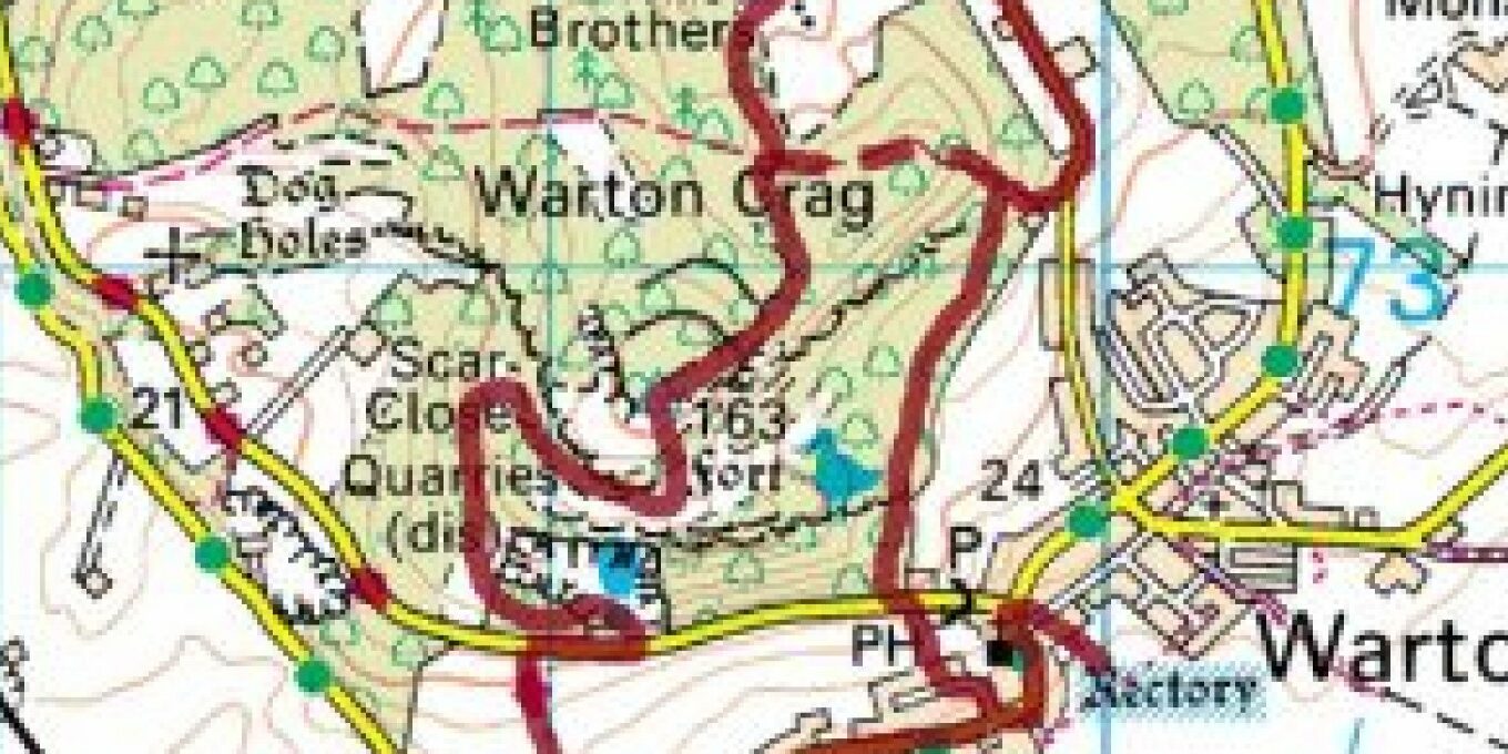
Walking route plan
A circular walk from Townend, over Warton Crag, taking in stunning vistas to the Lakeland and Bowland Fells and across Morecambe Bay.
- Start at the Town End bus stop
- Walk through the little public garden and turn left on to Sand Lane, crossing the road after 20m to the public footpath, signed Crag Road.
After 40m, cross stile and carry on up the hill keeping hedge close on your right. At the top, pass through the wall and turn right on to Crag Road, taking care. After 30m cross into Warton Crag car park. - To the left of the car park, take the path up through woodland. After 150m take right fork. Continue through wall and fence, then bear right on a path through scrub and follow the fence on your right. Continue in same direction across brambly field, crossing stile at far side. Continue straight up hill for 50m, climb small limestone outcrop and bear right to pick up path again.
- After 10m bear left through gap in scrub, then follow path to right, up the hill. Where the path levels, bear right along ridge to pass the seven sisters (large limestone boulders). Turn left to continue up hill, climbing stile to ascend limestone cliff. Take left fork and head uphill to reach summit and beacon.
- Stand with your back to trig point, and beacon straight behind that – follow path in front of you, through trees to join another path after 150m, continuing to descend. At next fork, take left path, going downhill for another 400m then pass through wall-squeeze next to gate, turn right to follow Occupation Rd bridleway.
- After 20m the route goes through the gate to follow a permissive bridleway via the Three Brothers Rocking Stones (three large glacial limestone boulders). For a shorter alternative continue along Occupation Road bridleway.
- If you take the permissive route, you come out next to a house. Turn right on to Coach Road and until you reach a small picnic area on right. Take bridleway to right and climb steeply for 50m until you reach gap in wall back into Warton Crag Nature Reserve.
- If you’ve continued down steep Occupation Road track, pass through another wall-squeeze
after 300m to follow footpath sign on right. - Follow path sharply down hill, climbing over rocks. Meet wall on the left, and stay left on the path, crossing a squeeze stile, until you reach a kissing gate in front of you, go through and continue down hill.
- Go through gate to Crag Road. Cross and pick up path signed Church Hill Avenue. Pass through kissing gate into estate. At the end of road, turn left on to Main Street, through the Warton conservation area, to reach rectory ruins on right. You may wish to end your walk with a visit to the village.
- Return via Main Street to Town End. Note short stretches of Main Street have no pavement.
For more information on holiday homes at Scout Cragg or more excellent ideas for walks in the area contact Daly Parks today.


